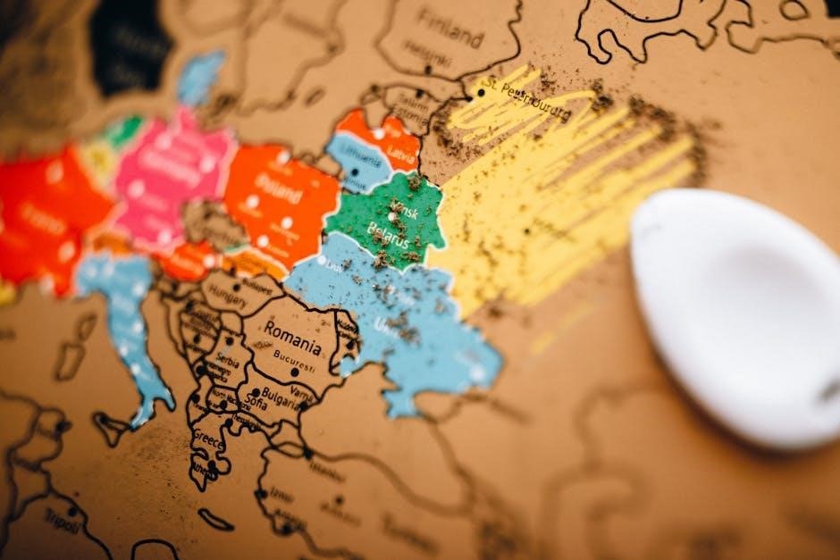
Bangkok Travel Guide Map: An Overview
Bangkok, a vibrant metropolis, demands a well-planned journey; a travel guide map is essential for navigating its bustling streets and discovering hidden gems.
Numerous maps, both downloadable and interactive, cater to tourists, pinpointing key attractions like temples, markets, and riverside experiences.
Understanding Bangkok’s transportation network – BTS, MRT, and river routes – is simplified with dedicated maps, ensuring seamless exploration of this dynamic city.
Bangkok, Thailand’s capital, is a captivating blend of ancient traditions and modern dynamism, a city teeming with life and offering an unforgettable experience for every traveler. Often described as a sensory overload, Bangkok presents a unique challenge and reward for exploration, making a comprehensive travel guide map an indispensable companion.
Home to over nine million people, Bangkok is a sprawling urban landscape, renowned for its ornate temples, bustling markets, vibrant nightlife, and delectable street food. Navigating this energetic city can initially feel overwhelming, with its heavy traffic and intense heat. However, with careful planning and the aid of a detailed map, visitors can unlock the city’s treasures and immerse themselves in its rich culture.
From the historical grandeur of the Grand Palace to the tranquil beauty of Lumphini Park, Bangkok offers a diverse range of attractions. A well-chosen map will not only guide you to these iconic landmarks but also reveal hidden gems and local experiences, ensuring a truly authentic travel adventure.
Why Use a Bangkok Travel Map?
Bangkok’s sheer size and complex network of streets necessitate a travel map for efficient and enjoyable exploration. Without one, navigating the city’s heavy traffic and diverse transportation options can be daunting, potentially leading to wasted time and missed opportunities.
A Bangkok travel map provides a visual overview of key attractions, allowing you to strategically plan your itinerary and prioritize sights based on location and interests. It simplifies understanding the BTS Skytrain and MRT subway routes, crucial for avoiding gridlock. Furthermore, maps highlight river taxi and ferry routes, offering a unique and scenic perspective of the city.

Beyond transportation, a map aids in discovering local eateries, hotels, and hidden gems often overlooked in guidebooks. It empowers independent exploration, fostering a deeper connection with Bangkok’s culture and ensuring a more fulfilling travel experience;

Navigating Bangkok: Essential Maps
Bangkok offers diverse mapping solutions: downloadable tourist maps, interactive attraction maps, and detailed transportation maps (BTS, MRT, river) for seamless exploration.
Downloadable Bangkok Tourist Maps
Downloadable Bangkok maps are invaluable for pre-trip planning and offline navigation. Several websites offer free, high-resolution maps detailing major attractions, hotels, and transportation hubs. These maps often include street names in both Thai and English, aiding orientation.
Look for maps specifically designed for tourists, highlighting key areas like the Old City (Rattanakosin), Riverside, and Sukhumvit. Many include suggested itineraries and points of interest. Before your trip, download several options to your phone or tablet, ensuring access even without an internet connection.
Consider printing a physical copy as a backup. These maps are readily available and provide a tangible way to visualize your route and explore Bangkok effectively. They are a cornerstone of independent travel within the city.
Interactive Bangkok Attraction Maps
Interactive Bangkok attraction maps offer a dynamic and user-friendly way to explore the city. These digital maps, often found on travel websites and apps, allow you to zoom in on specific areas, search for attractions, and view detailed information.
Many feature user reviews, photos, and opening hours, aiding in informed decision-making. Icons clearly mark points of interest, and clicking on them reveals further details. Some maps integrate with navigation apps, providing turn-by-turn directions.
The ease of use makes planning routes and discovering hidden gems incredibly simple. These maps are particularly helpful for identifying nearby restaurants, hotels, and transportation options, enhancing your Bangkok experience.
Bangkok Transportation Maps (BTS, MRT, River)
Navigating Bangkok efficiently requires understanding its diverse transportation system, and dedicated maps are crucial. The BTS Skytrain and MRT Subway boast clear route maps, readily available at stations and online, displaying all stops and interchange points.
For river travel, maps detail the Chao Phraya River express boat and ferry routes, showcasing piers and destinations like Asiatique. These maps often indicate connecting points to the BTS and MRT, streamlining multi-modal journeys.
Bus route maps, though sometimes complex, are available, and integrating these with digital maps can aid exploration. Mastering these maps unlocks Bangkok, saving time and enhancing your travel experience.

Key Tourist Areas & Attractions
Bangkok’s diverse areas – the Old City, vibrant Riverside, and modern Sukhumvit & Siam – offer unique experiences, best explored with a detailed travel map.
Old City (Rattanakosin)
Rattanakosin, Bangkok’s historical heart, is a treasure trove of cultural landmarks best navigated with a dedicated travel map. This area houses some of Thailand’s most iconic sites, demanding careful planning to maximize your visit.
The Grand Palace & Wat Phra Kaew (Temple of the Emerald Buddha) are essential stops, requiring ample time to explore their intricate architecture and spiritual significance. A map will help you navigate the complex and understand the dress code requirements.
Nearby, Wat Pho (Reclining Buddha) impresses with its colossal statue and traditional Thai massage school. Utilize a map to locate nearby eateries and transportation options after your visit.
Across the Chao Phraya River lies Wat Arun (Temple of Dawn), famed for its stunning riverside location and intricate porcelain decorations. A map will guide you to the ferry crossing for easy access.
The Grand Palace & Wat Phra Kaew
The Grand Palace & Wat Phra Kaew, a sprawling complex of royal residences and sacred temples, demands a detailed travel map for effective exploration. Navigating its numerous halls, courtyards, and shrines can be overwhelming without a clear guide.
A map highlights key structures like the Chakri Maha Prasat Throne Hall, Phra Mondop, and the stunning Emerald Buddha image within Wat Phra Kaew. It also indicates restricted areas and appropriate pathways for visitors.
Before your visit, consult a map to understand the strict dress code – shoulders and knees must be covered. Locate nearby shops selling appropriate attire if needed.
Utilize the map to plan your route, allowing ample time to appreciate the intricate details of the architecture and artwork. Consider joining a guided tour, often indicated on tourist maps, for deeper insights.
Wat Pho (Reclining Buddha)
Wat Pho, famed for its colossal 46-meter-long reclining Buddha, benefits greatly from a detailed travel map to navigate its extensive grounds. Beyond the iconic statue, the temple complex encompasses numerous other buildings, courtyards, and a traditional Thai massage school.
A map clearly indicates the location of the Reclining Buddha hall, as well as other significant structures like the ordination hall and various chedis. It helps visitors prioritize their exploration of this vast temple.
Tourist maps often highlight the massage school, a popular attraction, and provide information on booking treatments. Locate the entrance and exit points on your map to avoid confusion.
Utilize the map to find quieter corners of the complex, offering respite from the crowds. Remember to dress respectfully – shoulders and knees covered – as indicated on informational maps.
Wat Arun (Temple of Dawn)
Wat Arun, the stunning “Temple of Dawn,” is best explored with a comprehensive Bangkok travel map, given its riverside location and intricate design. A map will pinpoint the easiest routes to reach the temple, whether by river taxi or road.
Detailed maps showcase the temple’s central prang (tower), adorned with colorful porcelain, and the surrounding galleries. They highlight the best vantage points for photography, capturing the temple’s beauty against the Chao Phraya River.
Interactive maps often include information about the temple’s history and symbolism, enriching the visitor experience. Locate the various staircases and platforms on your map to plan your ascent.
River taxi route maps are crucial for accessing Wat Arun, indicating the nearest piers and connecting services. Remember to check the river taxi schedule on your map for efficient travel.
Riverside Area
The Bangkok Riverside area thrives as a central hub for tourism, demanding a detailed travel map for optimal exploration. A good map clearly illustrates the Chao Phraya River’s course and the locations of key piers for river transport.
Maps pinpoint popular attractions like Wat Arun and Wat Pho, showcasing their proximity to the river and suggesting convenient routes. They also highlight Chao Phraya River Cruises departure points and routes.
Asiatique The Riverfront is easily located on a map, revealing its layout, shops, restaurants, and entertainment options. Interactive maps often include walking directions from nearby BTS/MRT stations.
Utilize a Bangkok map to identify ferry routes connecting different riverside attractions, maximizing your time and experiencing the city from a unique perspective.
Chao Phraya River Cruises
A detailed Bangkok travel map is crucial for planning Chao Phraya River Cruises, showcasing departure piers and cruise routes. Maps often indicate different cruise options – dinner cruises, sightseeing tours, and hop-on-hop-off services.
Locate piers like River City, ICONSIAM, and Sathorn Pier on your map to determine the most convenient starting point based on your location. Interactive maps provide real-time information on cruise schedules and availability.
Maps highlight key landmarks visible during the cruise, such as Wat Arun, the Grand Palace, and Wat Pho, enhancing your sightseeing experience. Some maps even offer 360-degree views of the riverfront.
Utilize a Bangkok map to plan pre- or post-cruise activities near the piers, maximizing your time exploring the riverside area and its attractions.
Asiatique The Riverfront

Your Bangkok travel map will pinpoint Asiatique The Riverfront’s location along the Chao Phraya River, easily accessible by river taxi or BTS Skytrain (Saphan Taksin station). Maps detail the layout of this expansive night market and entertainment complex.
Interactive maps showcase the diverse range of shops, restaurants, and attractions within Asiatique, helping you navigate its various zones. Locate specific stores or dining options using the search function on digital maps.
Maps indicate the location of the Ferris wheel, Calypso Cabaret, and other entertainment venues, allowing you to plan your evening accordingly. River taxi routes on the map show convenient transport options to and from Asiatique.
Utilize a Bangkok map to identify nearby hotels and plan your transportation to and from Asiatique, ensuring a seamless and enjoyable experience.
Sukhumvit
Your Bangkok travel map highlights Sukhumvit Road as a long, bustling thoroughfare, crucial for planning exploration. Maps clearly delineate the numbered Sois (side streets) branching off Sukhumvit, essential for precise navigation.
Interactive maps pinpoint major shopping malls like Terminal 21 and Emporium, showcasing their locations relative to BTS stations. These maps often include floor plans, aiding in efficient shopping.
Maps also indicate the concentration of nightlife and entertainment venues along Sukhumvit, particularly in areas like Soi 11. Locate restaurants, bars, and clubs using detailed Bangkok attraction maps.
Utilize a Bangkok transportation map to identify the BTS Skytrain stations serving Sukhumvit, streamlining your travel. Hotel locations are also clearly marked on many maps, simplifying accommodation choices.
Shopping Malls (Terminal 21, Emporium)
A detailed Bangkok travel map is invaluable when planning shopping excursions to Sukhumvit’s renowned malls. Maps pinpoint Terminal 21, famed for its themed floors representing global cities, and the luxurious Emporium, showcasing high-end brands.
Interactive maps often provide floor plans of these malls, allowing you to pre-plan your route and locate specific stores; These maps can be accessed on your smartphone for convenient, on-the-go navigation.
Utilize the map to identify the nearest BTS Skytrain station – Asok for Terminal 21 and Phrom Phong for Emporium – streamlining your journey. Bangkok attraction maps also indicate surrounding dining options.
Consider using a map app with user reviews to discover hidden gems within the malls. These maps can help you maximize your shopping experience and find the best deals.

Nightlife & Entertainment
A comprehensive Bangkok travel map is crucial for navigating Sukhumvit’s vibrant nightlife scene. Maps highlight popular entertainment districts, from bustling Soi 11 to the upscale rooftop bars along Sukhumvit Road.
Interactive maps often feature user reviews and ratings of bars and clubs, aiding in your selection. These maps can also display transportation options, like taxi stands and BTS stations, ensuring a safe return;
Utilize the map to locate nearby restaurants for pre- or post-entertainment dining. Bangkok attraction maps sometimes include information on live music venues and shows.
Consider using a map app with real-time updates on events and promotions. These maps can help you discover hidden bars and experience the authentic Bangkok nightlife.
Siam
The Siam area, a shopper’s paradise, is easily navigated with a detailed Bangkok travel map. Maps clearly indicate the locations of major shopping centers like Siam Paragon and CentralWorld, essential for planning your retail therapy.
Interactive maps often showcase floor plans of these malls, helping you locate specific stores and restaurants. A Bangkok attraction map will pinpoint MBK Center, known for its bargain finds and diverse offerings.
Utilize the map to identify connecting walkways and BTS stations, streamlining your movement between malls. Tourist maps frequently highlight nearby dining options and entertainment venues.
Consider a map app with real-time crowd information to avoid peak hours. These maps can also display promotional events and sales happening within the Siam district.
Siam Paragon & CentralWorld
A detailed Bangkok travel map is crucial for maximizing your visit to Siam Paragon and CentralWorld, two of the city’s most iconic shopping destinations. Tourist maps pinpoint their exact locations and surrounding transport links, including the BTS Skytrain stations – Siam station provides direct access.

Interactive maps often feature floor plans, guiding you to specific brands, restaurants, and entertainment options within each mall. Utilize these maps to plan efficient shopping routes and locate amenities like restrooms and information counters.
Digital maps can highlight ongoing promotions and events, ensuring you don’t miss out on deals. A well-marked Bangkok attraction map will also show nearby attractions, allowing for a combined sightseeing and shopping experience.
MBK Center
Navigating MBK Center, a sprawling shopping haven, is significantly easier with a detailed Bangkok travel map. Tourist maps clearly indicate its location near the National Stadium BTS station, a vital transport hub. Interactive maps are particularly useful here, given the center’s vast size and numerous shops.
These maps often categorize stores by type – electronics, fashion, furniture – streamlining your search. Digital maps can highlight specific vendors or promotions, saving you time and effort. A Bangkok attraction map will show MBK’s proximity to other sights, allowing for a well-rounded itinerary.
Don’t underestimate the value of a floor plan; MBK’s multi-level layout can be confusing without one. Utilize available maps to efficiently locate desired items and enjoy a stress-free shopping experience;

Beyond the Main Attractions
Bangkok’s charm extends beyond iconic landmarks; a travel map unlocks hidden gems like Chatuchak Market and Lumphini Park, enriching your exploration.
Detailed maps reveal local eateries and unique neighborhoods, offering authentic experiences away from crowded tourist spots.
Chatuchak Weekend Market
Chatuchak Weekend Market, a sprawling labyrinthine marketplace, is a must-visit for any Bangkok explorer, and a detailed travel map is absolutely crucial for navigating its vastness.
Covering over 35 acres, with more than 8,000 stalls, the market offers everything imaginable – clothing, handicrafts, antiques, furniture, art, and delicious street food.
A map helps you strategically plan your visit, identifying sections of interest and preventing you from getting hopelessly lost amidst the bustling crowds.
Interactive maps often categorize stalls, allowing you to pinpoint specific items you’re searching for, saving valuable time and energy. Don’t underestimate the size; comfortable shoes and a map are essential!
Utilize a Bangkok travel map to locate the nearest BTS or MRT station for easy access, and plan your route accordingly to maximize your shopping experience.
Lumphini Park
Lumphini Park, Bangkok’s green lung, provides a tranquil escape from the city’s energetic pace, and a travel map assists in locating this urban oasis amidst the concrete jungle.
Spanning over 500 rai (approximately 80 hectares), the park offers walking paths, cycling routes, a lake for paddle boating, and open spaces for relaxation and recreation.
A Bangkok travel map clearly marks the park’s entrances and internal pathways, helping you plan your visit and discover its various features, including the Chinese Pavilion and the statue of King Rama VI.
Interactive maps can highlight amenities like restrooms, exercise areas, and food vendors, enhancing your experience. It’s a perfect spot for a peaceful stroll or a picnic.
Utilize your map to identify nearby BTS and MRT stations for convenient access, making Lumphini Park an easily accessible respite from the city’s hustle.
Khao San Road
Khao San Road, a legendary backpacker haven, is easily pinpointed on any comprehensive Bangkok travel map, serving as a central point for budget travelers and vibrant nightlife.
The map will reveal its location near the Grand Palace and Wat Pho, making it a convenient stop during explorations of Bangkok’s historical sites. Expect a bustling atmosphere filled with street food, shops, and bars.
Interactive maps can showcase the numerous hostels, guesthouses, and restaurants lining the street, aiding in accommodation and dining choices.
A detailed map also highlights the surrounding sois (side streets) where quieter accommodations and local experiences can be found, offering a respite from the main road’s energy.
Navigating Khao San Road is simplified with a map, ensuring you don’t miss its iconic landmarks and can easily access transportation options for further adventures.
Exploring Hidden Gems with a Map
A Bangkok travel map isn’t just for major attractions; it unlocks a world of hidden gems beyond the typical tourist trail. Detailed maps reveal charming local markets, tucked-away temples, and authentic eateries often missed by casual visitors.
Interactive maps, with user reviews and local insights, are invaluable for discovering these lesser-known spots. Look for areas slightly off the main thoroughfares, indicated on the map, to find unique experiences.
Utilizing a map allows you to venture into residential neighborhoods, uncovering traditional Thai life and local artistry. These explorations offer a deeper connection with Bangkok’s culture.
Don’t hesitate to explore the canals (khlongs) visible on the map, offering a different perspective of the city and access to riverside communities. A well-used map transforms your trip into an adventure.

Transportation Options & Map Integration
Bangkok’s diverse transport – BTS, MRT, river taxis – is easily navigated with integrated maps, streamlining your journey and maximizing exploration efficiency.
Route maps simplify planning, connecting attractions and ensuring smooth transitions between transport modes for a seamless travel experience.
BTS Skytrain Route Map
The BTS Skytrain is a remarkably efficient and convenient way to navigate Bangkok, especially during peak hours when road traffic can be incredibly congested. A detailed BTS route map is crucial for planning your journeys, showcasing the two main lines: the Sukhumvit Line and the Silom Line.
The Sukhumvit Line, the longer of the two, runs north-south, connecting key areas like Mo Chit, Asok, Nana, and Bearing. The Silom Line intersects with the Sukhumvit Line at Siam station, extending west to National Stadium and south to Bang Wa. Understanding the interchange points is vital for efficient travel.
Maps clearly display station names, numbered stops, and connections to the MRT subway system. Many maps also indicate nearby attractions and shopping malls, making it easy to plan day trips. Digital maps and apps offer real-time train schedules and estimated travel times, enhancing your Bangkok experience.
MRT Subway Route Map
Bangkok’s MRT subway system complements the BTS Skytrain, providing another efficient option for traversing the city, particularly for reaching areas not directly served by the elevated train. A comprehensive MRT route map is essential for navigating this underground network, which consists of the Blue Line and the Purple Line.
The Blue Line runs from Hua Lamphong station in the south to Lak Si station in the north, passing through central areas like Silom and Sukhumvit. The Purple Line extends from Tao Poon to Khlong Bang Phai, primarily serving the Nonthaburi province. Interchange stations, like Chatuchak Park, connect the MRT with the BTS.
Maps clearly illustrate station locations, line colors, and transfer points. Many maps also highlight nearby tourist attractions and landmarks. Digital maps and mobile apps provide real-time train information and journey planning tools, streamlining your Bangkok exploration.
River Taxi & Ferry Routes
The Chao Phraya River and its network of canals (khlongs) offer a unique and often faster way to navigate Bangkok, escaping the congested roads. Utilizing river taxis and ferries requires understanding the various routes, best visualized with a dedicated map.
Several services operate, including the Chao Phraya Express Boat, offering different speeds and stops, and local ferries connecting to various piers along the river and khlongs. Maps detail the flag-down fares and route numbers, crucial for budgeting and planning.
These routes provide access to iconic attractions like Wat Arun and the Grand Palace, as well as offering glimpses into local life along the waterways. Digital maps often integrate with journey planning apps, providing real-time schedules and estimated travel times, enhancing your Bangkok experience.

Planning Your Trip with a Bangkok Map
Bangkok maps empower travelers to craft personalized itineraries, locate hotels and restaurants, and efficiently explore the city’s diverse offerings with confidence.
Creating a Custom Itinerary
Utilizing a Bangkok travel map is paramount when designing a personalized itinerary. Begin by identifying your core interests – historical sites, vibrant markets, or modern shopping experiences.
Pinpoint key attractions like the Grand Palace, Wat Arun, and Chatuchak Weekend Market on your map, then strategically cluster nearby points of interest to maximize your time.
Consider transportation options; the BTS Skytrain and MRT Subway route maps will help you plan efficient routes between locations. Factor in travel time, especially during peak hours.
Don’t hesitate to venture off the beaten path! Explore hidden gems suggested by local guides or online resources, marking them on your map for spontaneous discoveries.
Remember to balance iconic landmarks with immersive cultural experiences, creating a well-rounded and unforgettable Bangkok adventure tailored to your preferences.
Using Maps for Food & Hotel Locations
A Bangkok travel map extends beyond sightseeing, becoming an invaluable tool for culinary and accommodation planning. Utilize online maps with user reviews to discover highly-rated restaurants, street food stalls, and cafes near your chosen attractions or hotel.
Filter searches by cuisine, price range, and dietary restrictions to refine your options. Pinpoint your hotel’s location and assess its proximity to public transportation hubs like BTS and MRT stations.
Explore different neighborhoods using the map to identify areas offering a diverse range of dining experiences, from upscale restaurants to local eateries.
Consider the convenience of nearby amenities, such as convenience stores and pharmacies, when selecting your hotel. Interactive maps often display walking distances and estimated travel times.
Ultimately, a well-utilized map ensures you’re never far from a delicious meal or comfortable lodging during your Bangkok exploration.
Song Wat Road ⎻ Emerging Landmark
Song Wat Road is rapidly gaining recognition as a new Bangkok landmark, fueled by initiatives from the Commerce Ministry and the Bangkok Metropolitan Administration (BMA). A Bangkok travel map should now include this burgeoning destination for those seeking authentic local experiences.
Previously a relatively unknown area, Song Wat Road is being promoted for its unique character and potential for tourism. Explore the map to locate its position and plan a visit to witness its transformation firsthand.
Expect to discover a blend of traditional shops, local eateries, and a vibrant street life. The area offers a glimpse into Bangkok’s evolving urban landscape.
As development progresses, Song Wat Road promises to become a compelling addition to any Bangkok itinerary, offering a different perspective beyond the established tourist trails.
Keep an eye on updated maps for the latest developments and points of interest along Song Wat Road.